There is something unsettling about knowing your family hails from the dark side of the Carpathians. Images of Vlad the ignomineous prince who inspired the legend of Dracule immediately come to mind. I will have to trust that none of my antecedents worked as stick sharpeners for the impaling emperor.
Below are listed what few facts about the land I could glean from the net.
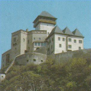
Castle of TrencinKnown since 1111. Originally anti-Turk fortress. In the castle hill there is inscript commemorating the victorious battle of Romans over Germans fought in 178. |
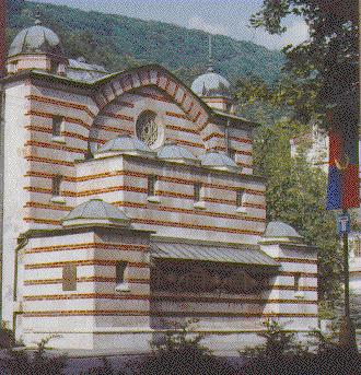
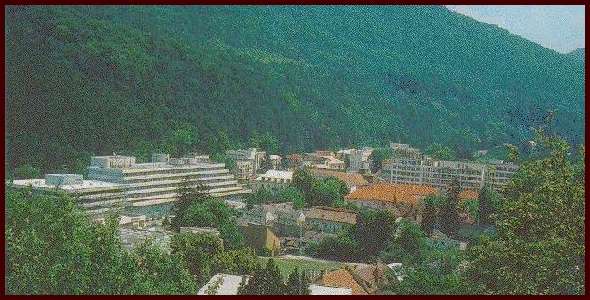
Trencianske Teplice SpasOne of the most ancient Slovak spas, situated in the north-west of Slovakia, near Trencin amidst Strazovske Hills, 282 m above sea level. It is surrounded by evergreen forest and accessible from Trencianska Tepla railway station by bus or electric train. The basis of treatment is curative mineral water and sulfureous mineralized mud useful for the treatment of the mobility problems, post operative or accident trauma as well as some types of neurosis and neurological disorders. |
Slovakia is a mountainous and most distinctive region. It consists mainly of the curving line of the Carpathian Mountains, here made up of a series of parallel ranges. To the southwest their direction is continued into Austria, where they link up with the Alpine system. To the east they extend through Ruthenia into Rumania. The highest of the ranges is the High Tatra (Vysoke Tatry), a small area of rugged mountain peaks, which rise to 8,737 feet (2,683 meters). To the south lie the Low Tatra (Nizke Tatry), rising to more fattened summits between 5,900 and 6,500 feet (1,800-2,000 meters). Farther south again are the Slovak Ore Mountains (Slovenske Rudohorie), which have for many years been an important source of silver, as well as of iron and nonferrous metals.
The mountain valleys of Slovakia open toward the Hungarian Plain and are mostly drained by the Vah, Hron, and Hornad rivers to the Danube. South of the mountains are several areas of low-land, extensions of the Hungarian Plain itself. The largest of these borders the Danube to the east of Bratislava, and is crossed by the Vah and Hron. There are smaller areas of lowland in the east, including the plain of which the city of Kosice is the center.
The direction of the valleys gives Slovakia an orientation toward Hungary, and from the 10th century until 1918 it was generally considered part of the Hungarian state. Thus, the Slovaks were cut off from the Czechs, with whom they were ethnically closely related, and they did not share in the economic development of the Czechs. When, in 1918, Slovakia was joined to the Czech provinces of Bohemia and Moravia, it was a relatively backward province.
Much, however, has been done to develop Slovakia. Its capital, Bratislava, has become an important industrial city as well as a Danube port. The rivers of Slovakia have been developed as sources of hydroelectric power, and the small iron ore and brown coal reserves have been exploited. Many of the small towns within the mountain valleys, notably Zilina, Zvolen, and Rutomberok, have become important manufacturing centers, and the city of Kosice developed after World War II into an important steel center.